A European First at URCA: A Revolutionary Drone to Measure CO₂ and H₂O Fluxes
In the fight against climate change, precisely understanding the exchange of greenhouse gases (GHGs) between land and atmosphere is a crucial step. Yet scientists faced a major obstacle: the most reliable method for measuring these fluxes, known as eddy covariance, had until now been limited to heavy, stationary equipment—difficult to move and only capable of covering small areas.
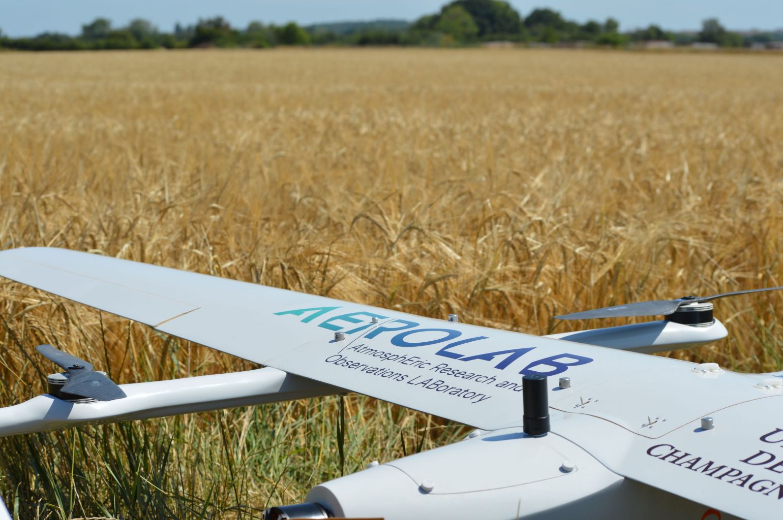
This is where the ANR ATMOSFERE Chair (held by Lilian Joly), led by the AEROLAB team at the University of Reims Champagne-Ardenne (URCA) in collaboration with TotalEnergies, changed the game. Their idea? Adapt this exceptional method to a VTOL drone (capable of vertical takeoff and landing) to finally measure gases like carbon dioxide (CO₂) and water vapor (H₂O) across large territories, with full mobility.
The challenge: making a heavy technology mobile
Traditionally, the eddy covariance method requires fixed towers or stations equipped with sophisticated sensors to capture air turbulence and rapid variations in gas concentrations. While highly accurate, these installations are limited: they “see” only a small section of the landscape and cannot easily explore larger or hard-to-reach areas.
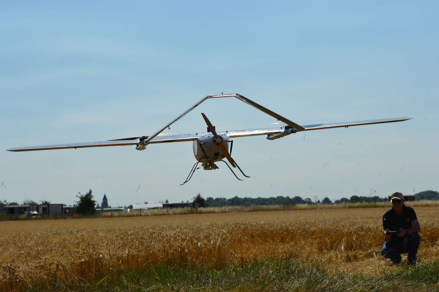
The ATMOSFERE Chair tackled this challenge by miniaturizing and integrating these instruments into a VTOL drone weighing under 3 kg. This drone combines the vertical takeoff ability of a multicopter with the cruise efficiency of a small airplane. Thanks to it, researchers can now fly over forests, fields, or natural areas and collect precise data on CO₂ and H₂O fluxes.
Innovation validated in real-world conditions
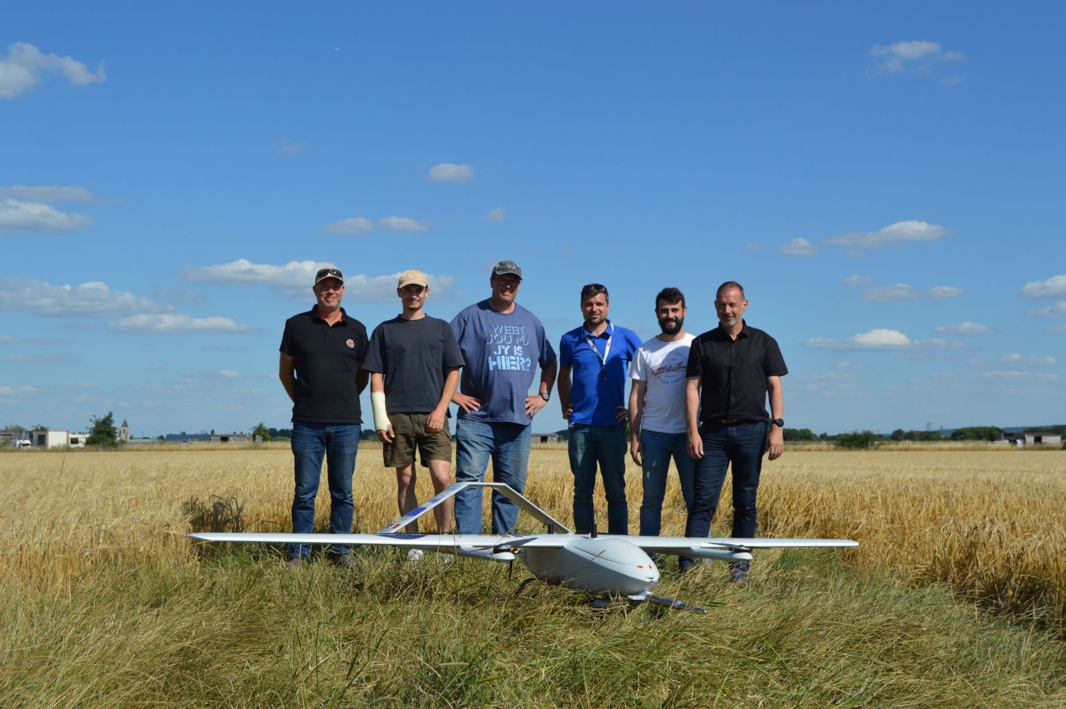
Last week, the team conducted its first test flights at the Brétigny airbase. These experiments confirmed that the instruments work perfectly in flight, that the measurements are reliable and synchronized, and that the drone can operate in varied conditions.
This achievement marks a European first: never before had such a demanding and heavy method been successfully deployed on such a light and agile drone.
Toward a global breakthrough with methane measurement
What’s next? Adding a methane (CH₄) sensor—a greenhouse gas 28 times more powerful than CO₂. Integrating this technology would make the drone a world first, capable of monitoring methane emissions in motion, particularly in sensitive zones such as peatlands or permafrost.
Why this breakthrough matters
With this innovation, it becomes possible to map greenhouse gas emissions accurately and quickly across large areas. These data will feed climate models, improve the management of soils, forests, and agricultural lands, enhance our understanding of permafrost regions, and strengthen strategies to combat climate change.
A source of pride for URCA and European research
This flagship project places the University of Reims Champagne-Ardenne and France at the forefront of environmental research. It illustrates how science can push past technical barriers to deliver powerful tools in service of the planet and its people.
As Lilian Joly, holder of the ATMOSFERE Chair within AEROLAB, emphasized:
“The progress achieved by the AEROLAB team is the result of true collective work, bringing together high-level, multidisciplinary expertise at URCA. It opens up new possibilities for mapping greenhouse gases and deepening our understanding of their emissions, with many applications—both industrial and academic—particularly in the study of agriculture, forests, peatlands, and permafrost.”
Acknowledgments:
- Brétigny Systematic Hub, Natacha Lalanne (Coordinator of the DRONES Hub, Systematic Paris-Region, and Director of LFR33 - ZRT SUD FRANCILIEN 1 and 2 flights)
- Jean-Marie Unger (Operations Manager and Drone Pilot) and his team (ROAV7).
Photo credits: all rights reserved